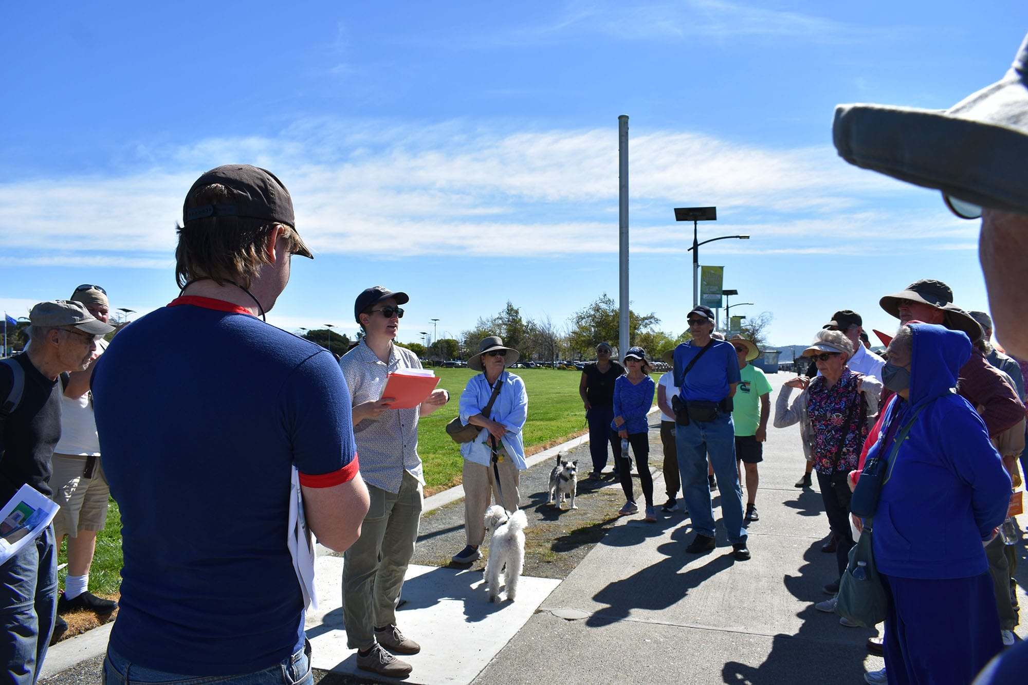
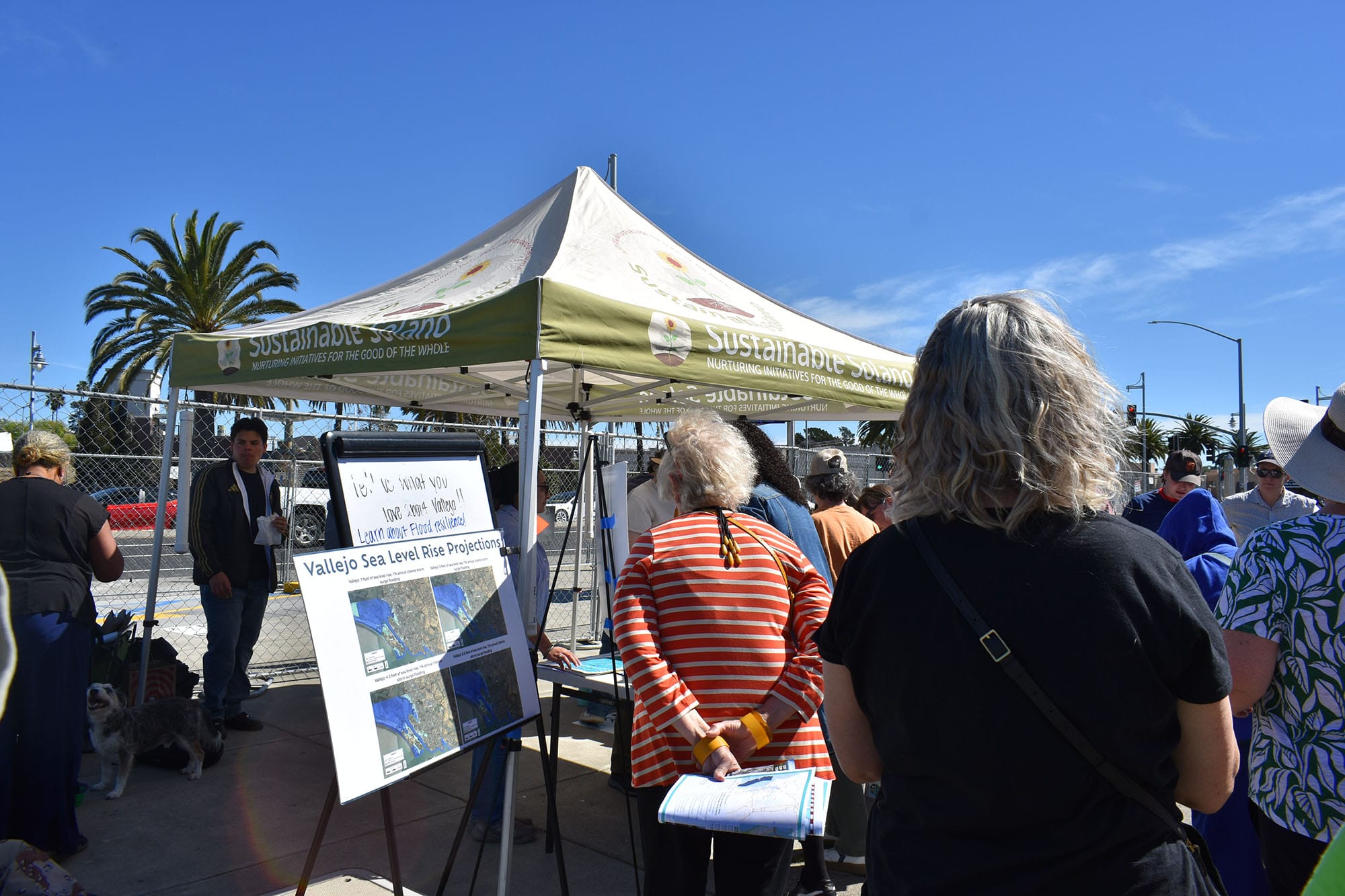
VALLEJO – Environmental groups working with the city hosted a walk along the Vallejo waterfront on Saturday to explain to residents what areas were in danger of flooding by 2050 and why, part of a project to address sea level rise caused by climate change required under a 2023 state law.
Sea levels have been rising globally since the 1800s due to greenhouse gases, and the Bay Area is expected to experience around 10 inches of sea level rise by 2050, according to the Solano Bayshore Resiliency project.
About 50 people attended the walk on Saturday and listened to presentations by Nate Huntington, a resilience manager with Greenbelt Alliance, and Ellen Plane, a senior scientist at the San Francisco Estuary Institute.
Plane explained that some of the city’s man-made structures — like concrete streets and waterfront walkways — present challenges for dealing with potential flooding in the future.
Plane said the Vallejo waterfront and parts of South Vallejo are built on fill, which was created by piling soil, mud, rocks, and dirt on top of wetlands. This was a common building technique in the 1800s because it allowed people to build and live in areas that used to be uninhabitable. Congress also passed several Swamp Land Acts in the mid-1800s to encourage this kind of construction.
“Prior to human development, we would have been standing up to our knees in water right now, in an open water habitat,” Plane said. “But because land was so valuable here for development, there’s been a lot of expansion out into the bay itself.”
The government stopped using fill in the 1960s due to growing environmental concerns. “But we still have a lot of legacy areas, like where we're standing today” that could be prone to flooding if the waters rise, said Plane.
The waterfront also has “gray infrastructure,” which is an artificial structure like a levee or a seawall that keeps the filled areas dry and prevents erosion of the shoreline. As sea levels rise, seawalls that aren’t maintained properly might fail to prevent flooding.
Plane also explained that even the city’s sidewalks and roads can cause issues if there’s a huge storm.
“In the future, you’ll see puddles not really draining during the wet season. So that’s something we have to think about as we develop sea level rise adaptation plans in the region,” Plane said. “We can’t just build walls everywhere to keep the water out because we have these other sources of flooding to think about.”
Rachelle Canones, a community outreach specialist at the Vallejo Flood & Wastewater District, talked about how potential flooding could impact the wastewater treatment plant in South Vallejo that serves the whole city.
Canones explained that most wastewater plants are built on the lowest lying parts of a city because they use gravity to move wastewater from residents’ homes to the plant, where it's treated before being released back into the ocean.
If the facility floods during a massive storm, “It’s going to be an issue for the entire service area,” Canones said.
“We can already see some settling under some of our facilities,” Canones added, referring to the fill being reclaimed by the wetlands. “You can see where the cement was, and there’s a gap.”
The facility has been replacing aging infrastructure since 2024, and Canones said they’re already thinking of how they’re going to deal with building weaknesses resulting from rising water.
Canones also touted the district’s partnership with the California Native Plant Society’s Willis L. Jepson chapter as an example of how a city’s resiliency plan could include creating more recreational green spaces that naturally absorb water.
She pointed to Lake Dalwigk Park off Curtola Parkway. One hundred years ago, Lake Dalwigk was a body of water that flowed into the Mare Island Strait, but railroad development cut it off. This caused routine flooding for decades until the city dredged and deepened the lake in 2012. They then partnered with the Native Plant Society in 2017 to plant 240 native trees and thousands of native wildflowers, turning it into a park.
Huntington told attendees that they’ll continue to engage with the community until they move into the next phase of the project, which is when they start discussing actionable strategies. As Huntington noted at a prior meeting, the environmental groups are gathering community input in order to provide guidance to the city, but the Vallejo City Council will ultimately decide what makes it into the resiliency plan. The city has until January 2034 to submit it.
Still, the organizers stressed that it’s important that residents make their voices heard now.
“It can seem daunting, but this is an opportunity to think about what you love and care about in your community, and how you want to see your community grow and change in the future,” Huntington said. “It's not just doom and gloom. It's an opportunity to think about how to improve.”
Before you go...
It’s expensive to produce the kind of high-quality journalism we do at the Vallejo Sun. And we rely on reader support so we can keep publishing.
If you enjoy our regular beat reporting, in-depth investigations, and deep-dive podcast episodes, chip in so we can keep doing this work and bringing you the journalism you rely on.
Click here to become a sustaining member of our newsroom.
THE VALLEJO SUN NEWSLETTER
Investigative reporting, regular updates, events and more